The 7.0.8522 version introduces the following features:
[CDO] Simplified access to tabs
- C&D Online Analyst/Expert users can now access the various Visualization tabs in the flowchart creation interface more easily, when there are a lot of them. This helps users save time and find the tabs more easily.
[CDO] Articque DataMarket module: configuring the module to use it in an Atlas
- LC&D Online Analysts/Experts can now vary the filters of the Articque DataMarket module in order to use it in the generation/configuration process of an Atlas.
- This variation can, for example, relate to the department code, the INSEE municipality code, etc.
- This variation can only relate to qualitative data.
[CDO] Custom map module: uploading a GeoJSON base map for editing
- The Custom map module now allows users to edit an existing GeoJSON base map with points, lines or polygons.
- The interface of the module has changed to allow:
- The selection of a GeoJSON base map that was already uploaded or available in the files and in the C&D Online groups accessible to the user.
- The direct upload of a new GeoJSON file from the user’s work station by selecting it on the hard drive or by drag and drop.
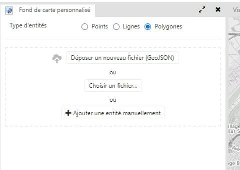
- Once the GeoJSON base map is selected or uploaded, the list of its entities appears and the user can modify them through editing.
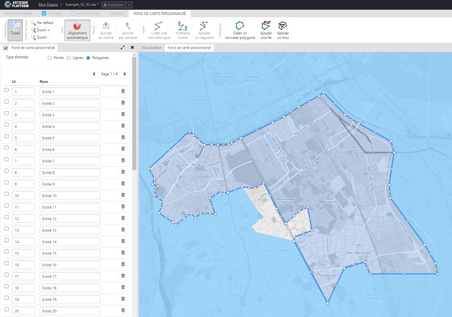
- The export in GeoJSON format of a modified GeoJSON base map is executed through the Export => Map menu of the flowchart
- NB: the manual creation of entities (points, lines, polygons) is still possible in the Custom map module.
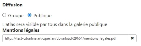
[CDO] Atlases: link to legal notices
- Expert C&D Online users who create public atlases can now add a clickable hypertext link leading to the legal notices of their website:
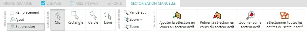
[CDO] Manual districting: viewing the average and selecting all the entities of an active district
- The Manual districting module now displays a line on the balancing chart in order to represent the average of districts for a variable.
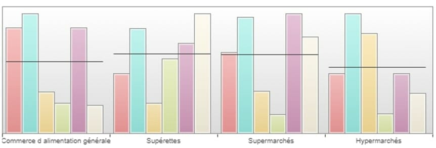
- It is now possible to select all the geographic entities of an active district with one click.
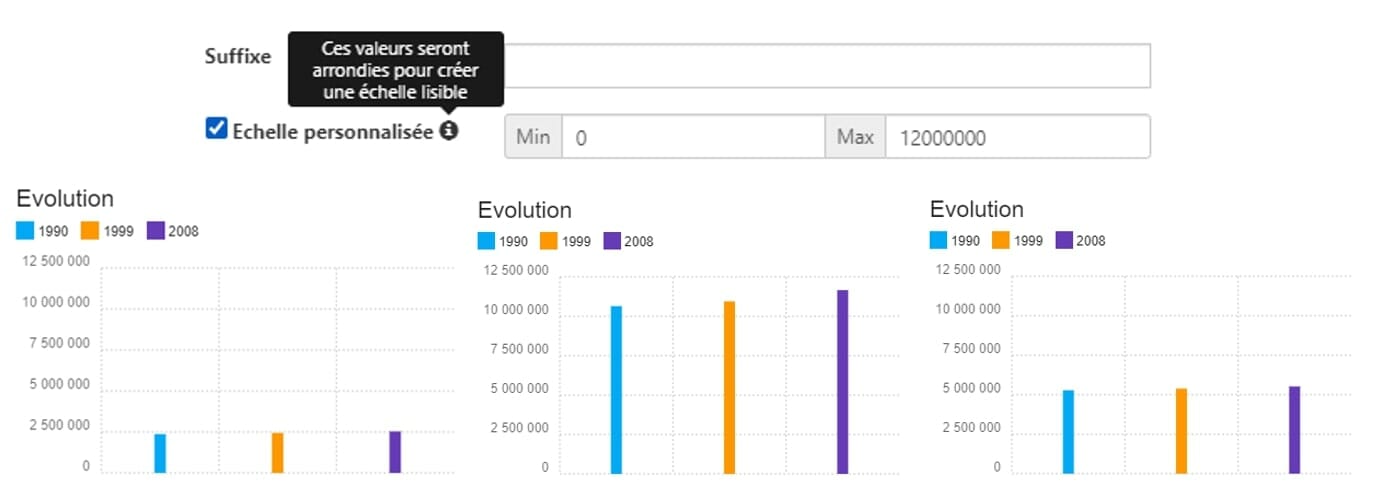
[CDO] Global charts: new options for configuring the vertical axis
- It is now possible to configure the scale of the vertical axis more finely for global charts (Plot charts and Bar charts).
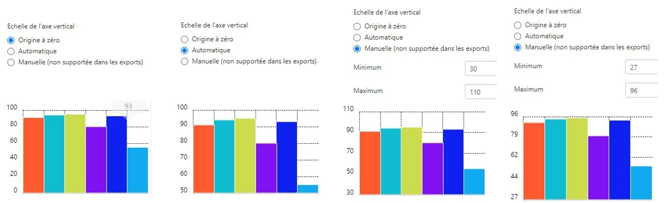
[CDO] Charts in tooltips and popup cards: configuring the minimum/maximum values of the vertical axis
- It is now possible to configure the minimum and maximum values of the vertical axis for charts within tooltips and popup cards.
[CDO] Atlases: suggestions for improvements
- When the lateral navigation of an atlas can be improved to reduce its size, Expert users are now notified when the atlas is generated.

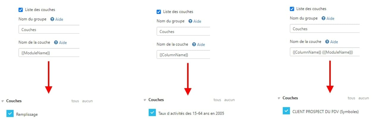
[CDO] Atlases: names of the dynamic layers
- Expert users can now use variables in the layer names of their atlases in order to make dynamic changes according to the name of a module and/or the name of a data column.


 The new features of Articque Platform of August 2021